blah blah blah
Church Pond
Length: 2.2 miles out-and-backDifficulty (click for info): Easy
Elevation Gain: 50 feet (+0 feet on return)
Rating (click for info): 7/10
Elevation: 1241'
Driving Directions:
Trailhead is on the loop road through Passaconaway Campground, off the Kancamagus Highway. The entrance is on the north side of the road, 21 miles east of exit 32 off I-93 in Lincoln and 14.2 miles west of the junction with Rt. 16 in Conway. It is marked with a large recreation sign. Look for it just west (almost across the street) of the Downes Brook Trailhead, also clearly marked, and a quarter mile east of the bridge over Downes Brook. Drive into the campground and bear left at the first fork, then bear right around the loop road through the tentsites. In 0.1 miles, the road takes a sharp left turn to loop back around. Look for the signpost marking the trailhead at this point. There is very limited space where just a few cars can park. Click here for a Google map.
About the Hike:
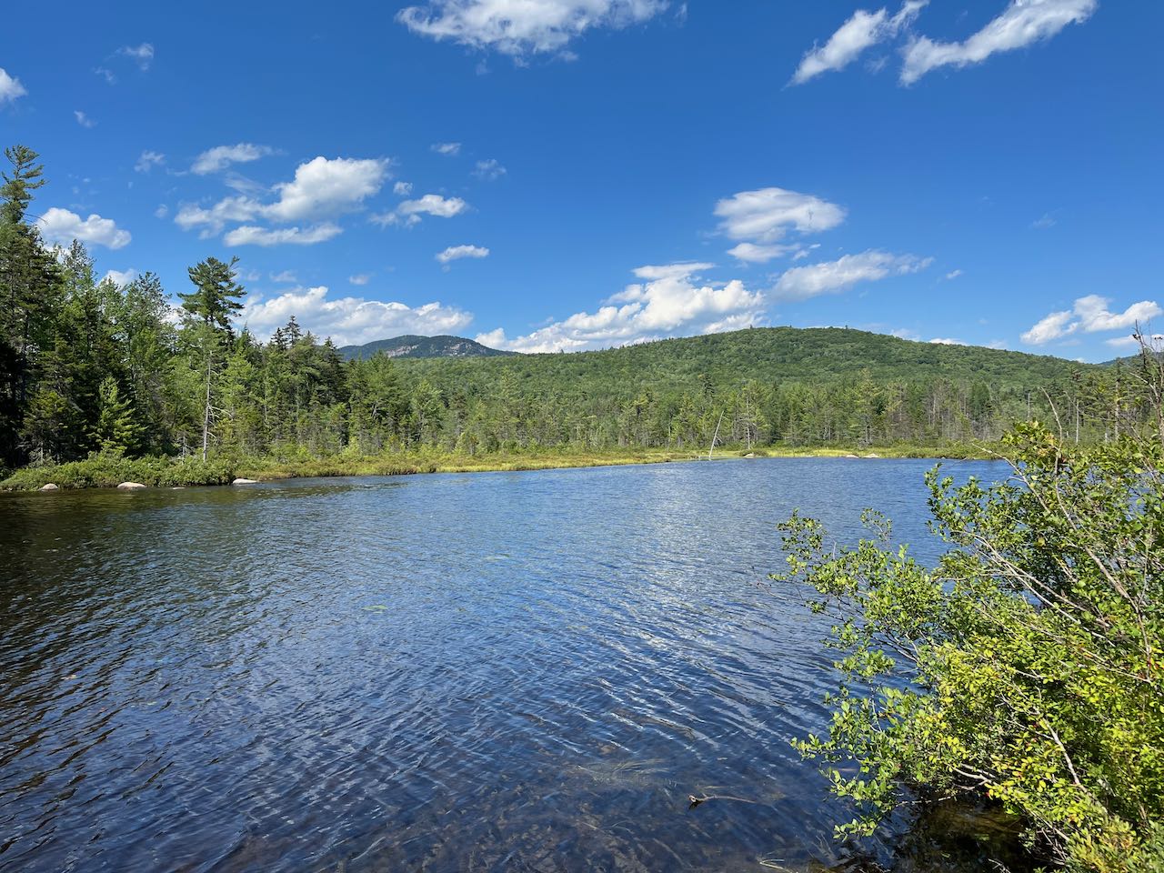
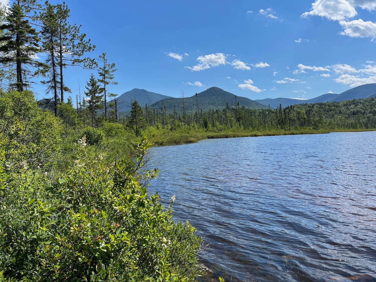
This remarkably scenic pond is within easy walking distance of the most popular tourist highway in New Hampshire but remains peaceful and secluded, seldom visited for one reason, being that to reach it you must wade across the Swift River. This is an easy task when the conditions are right, but it requires some preparation. You'll want to plan your visit in the later summer or fall to ensure the current is not dangerous to walk through, and you'll have to bring footwear suitable for wading and also for the one-mile walk to the pond. If you're willing to put in the effort to meet these challenges, you'll be rewarded with a delightful mountain vista over the crystalline waters of the pond. The walk there is almost as beautiful as you'll stroll along an extensive boardwalk chain through the vast bog around the pond that's larger than the extent of the water.
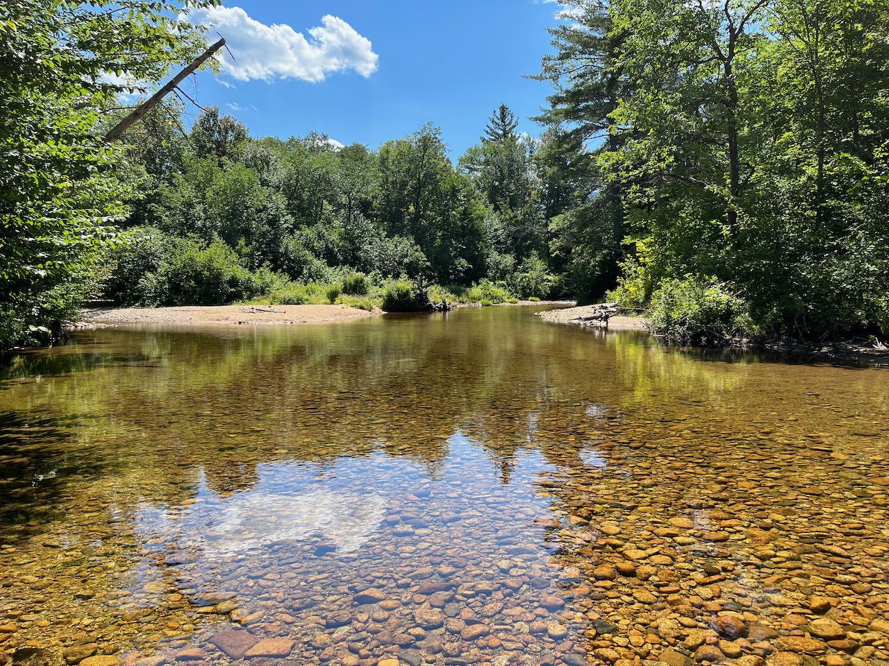
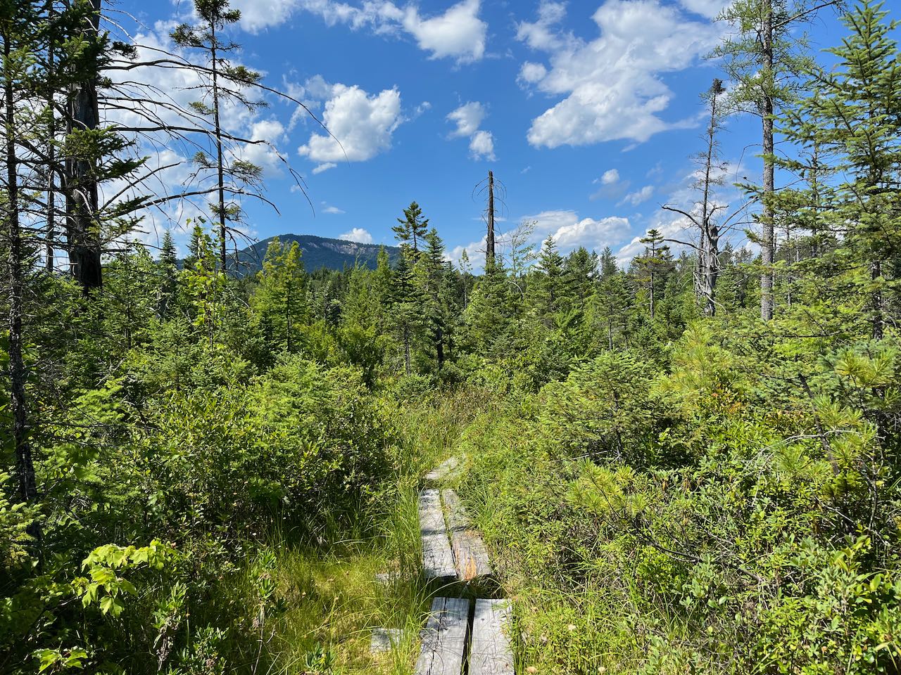
From the trailhead, walk past the row of boulders and drop down to the riverbank. When water is low, most of the river's channel will be dry, and there will only be a narrow and shallow section to wade across. Medium-sized smooth stones abound underfoot, so use caution. Look carefully for the trail on the other side as it enters the woods under overhanging boughs. It meanders through a sandy floodplain for 0.1 miles and then crosses another channel of the river where water is more sluggish and stagnant and which may also require getting your feet wet. Pick up the trail as it climbs up a brushy bank and heads back into the woods. It may be difficult to find in this section; it swings left and generally parallels the river. The pathway, carpeted with pine needles, leads over level ground for 0.15 miles to a trail junction, where a cross-country ski trail joins from the right. Now you can follow the blue diamonds for the next 0.4 miles as the trail remains perfectly level through mixed forest. Then, the ski trail splits off to the left, and the hiking trail mounts the first of the bog bridges through the huge wetland area.
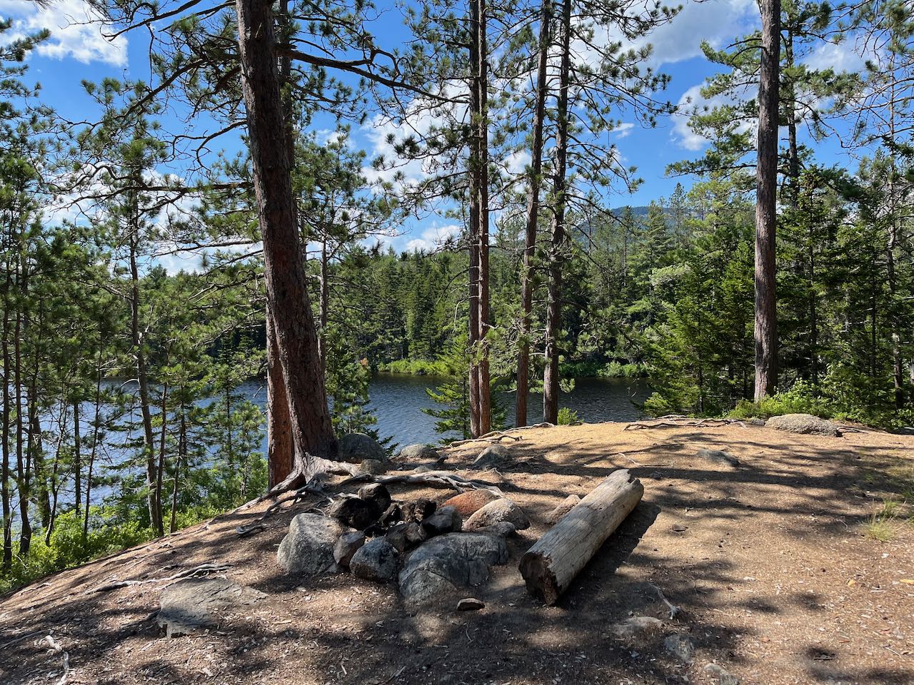
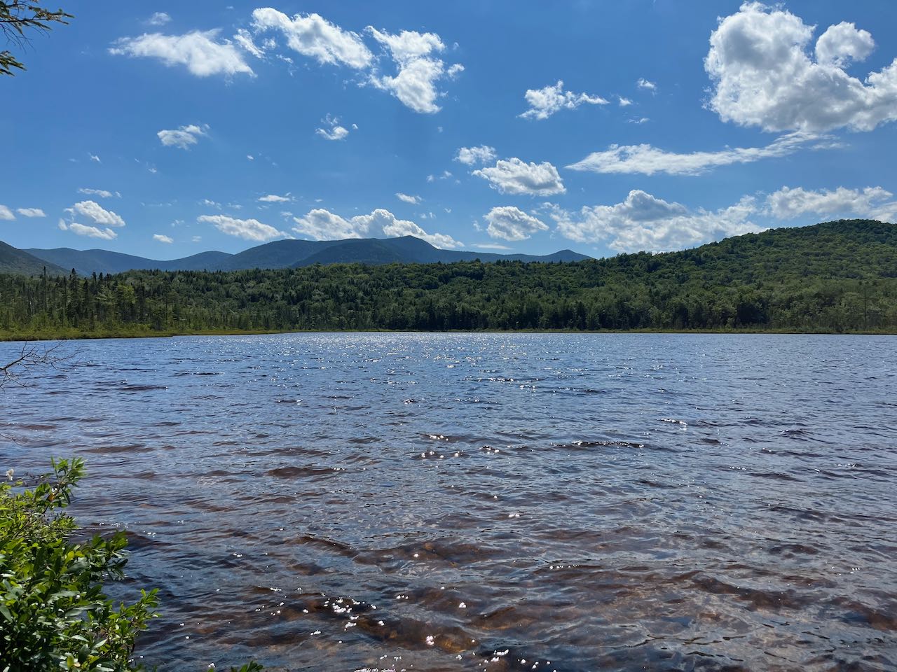
Enjoy the easy walk through this environment of unique vegetation and scattered views of the surrounding mountains. The trail is mostly closed in at first, but as you begin to approach the pond, the trees thin out and views appear, with Green's Cliff rising prominently in the distance. This scenic walk goes on for 0.35 miles before the boardwalk ends and the trail returns to firm ground. It climbs up to a prominent knoll near the northeast end of the pond, the only elevation change you'll notice for the entire walk from the river. From the clearing around the top of this hump, you can see through the trees over the water, but you can drop down to the water's edge to find the best views. Several paths lead down to different points on the shore of the pond, which are all worth exploring. The most open spots to the left offer a gorgeous view over the clear blue surface toward Mt. Tripyramid. It is presented from an unusual angle here in which you cannot see the three peaks. On the right side is Scaur Peak, and on the left side is the rolling Sleeper Ridge. In your immediate surroundings, you can look back over to the bog which the trail passed through to arrive here. Over the bog rise two pointy peaks, nearby Potash Mountain, and its much larger neighbor Mt. Passaconaway to the left. Points further to the right offer a view of the outlet end of the pond, where the rocky ledges of Owl's Cliff and Mt. Tremont rise behind.
Printable directions page